Lake Iriki
Lake Iriki
A seasonal basin in southern Morocco listed on the RAMSAR register, Lake Iriki combines Saharan landscapes, discreet wildlife and stopovers for migratory birds.
Lake Iriki is a temporary wetland located between the Drâa river and the southern foothills of the Anti-Atlas, near the Algerian border. Most often dry, this endorheic basin transforms into a stopover for migratory birds during rainy months. It is part of Iriki National Park, approximately 150 km south of Ouarzazate and 80 km southwest of Zagora.
Why visit Lake Iriki
Lake Iriki appeals to travellers seeking vast, little-visited Saharan landscapes. Unlike the more publicized dunes of Merzouga or Erg Chigaga, this site remains off the beaten track. You'll find a rare combination: a dried lakebed bordered by acacia savanna and wooded steppe, discreet Saharan wildlife and seasonal presence of water birds.
The area is listed among Morocco's RAMSAR-designated wetlands in recognition of its importance for migratory birds from western Palearctica. Its management falls under the High Commission for Waters, Forests and the Fight Against Desertification (HCEFD).
History and protected status
Lake Iriki and its basin are part of Morocco's protected areas progressively established between 1924 and 1994, culminating in the creation of Iriki National Park. RAMSAR listing reinforces this status by recognizing the site's ecological importance for migratory birds from Northern Europe and Western Siberia.
The zone has long been inhabited and traversed. Nomads, mostly from M'hamid, practice transhumance there and use these seasonal pasturelands. Nearby, several sites feature prehistoric rock engravings, evidence of ancient human occupation in a region that was, on a geological timescale, far more humid than today.
What to see and do
The lakebed and its landscapes
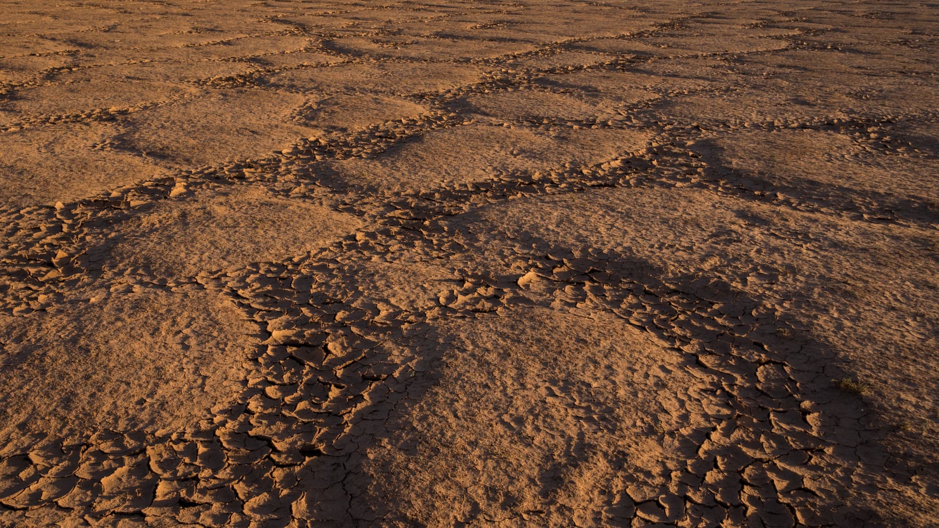
When dry, the basin offers a flat surface, cracked in places, that can be crossed on foot, by 4x4 or camel-back. The contrasts between the pale soil, sparse acacias and distant Anti-Atlas reliefs constitute the site's main visual appeal.
Saharan wildlife
The park is home to southern gazelles, arched-horned sheep and, more rarely, striped hyenas. Reptiles are numerous: lizards, snakes and chameleons. These animals remain elusive; observing them requires patience, calm and the guidance of a local guide familiar with water sources and animal passages.
Migratory birds
During wet periods, typically between October and December, the lake may welcome flamingos, geese, coots and various waders. Water presence depends on annual rainfall; some seasons remain dry.
Rock engravings
Several prehistoric rock engraving sites are found nearby. They depict fauna now vanished from the region and bear witness to the green Sahara. Visits are made with a guide.
When to visit
The climate is hot and desert-like. October to April are the most comfortable months for visiting, with mild days and cool to cold nights. Summer (June to August) is marked by very high temperatures and is not recommended for excursions.
To observe migratory birds and possibly see the lake with water, aim for late autumn and early winter. For hiking and camping, winter and early spring offer the best conditions.
Practical information
- Duration of visit: plan for a minimum of one day from M'hamid or Zagora, two to three days for a circuit with camping.
- Guided tours: visits are done with a local guide and suitable vehicle; independent access is not recommended.
- Accommodation: camping under nomadic tents, sometimes in semi-permanent camps set up by agencies.
- To bring: plenty of water, covering clothing, sun protection, headlamp, warm clothes for the night.
- Rates: organized excursions vary depending on duration and number of participants; inquire with agencies in M'hamid or Zagora.
How to get there
The nearest airport is Ouarzazate, served by flights from several European cities depending on the season. Marrakech-Ménara, more widely connected, is a classic alternative, at the cost of a longer journey.
From Ouarzazate, the road descends toward Agdz then Zagora, and continues to M'hamid, the usual starting point for excursions to Lake Iriki. From Marrakech, expect a full day's drive crossing the High Atlas via the Tizi n'Tichka pass.
On the ground, several modes of transport are used:
- 4x4: the most common way to reach the basin and its surroundings.
- Camel: for slower approaches and itinerant camping.
- Quad: offered by some agencies, led by a guide.
- On foot: over short distances, as part of a guided trek.
Nearby attractions
- M'hamid el Ghizlane: gateway village to the desert, starting point for excursions to Iriki and Erg Chigaga.
- Zagora: stopover town in the Drâa valley, 80 km to the northeast.
- Drâa Valley: long oasis dotted with ksour, on the route between Ouarzazate and Zagora.
- Ouarzazate: regional logistics hub, with film studios and the Taourirt kasbah.
- Erg Chigaga: large dune ridge located north of the Iriki basin, often combined in the same circuit.
Frequently asked questions
Frequently asked questions
Plan your trip
Lake Iriki logically fits into a larger circuit in southern Morocco, combining the Drâa valley, Erg Chigaga and kasbahs in the Ouarzazate region. To build a tailor-made itinerary, consult our Morocco travel suggestions.
Interested in this visit?
We can include it in your personalised itinerary.