Dayet Aoua Lake
Dayet Aoua Lake
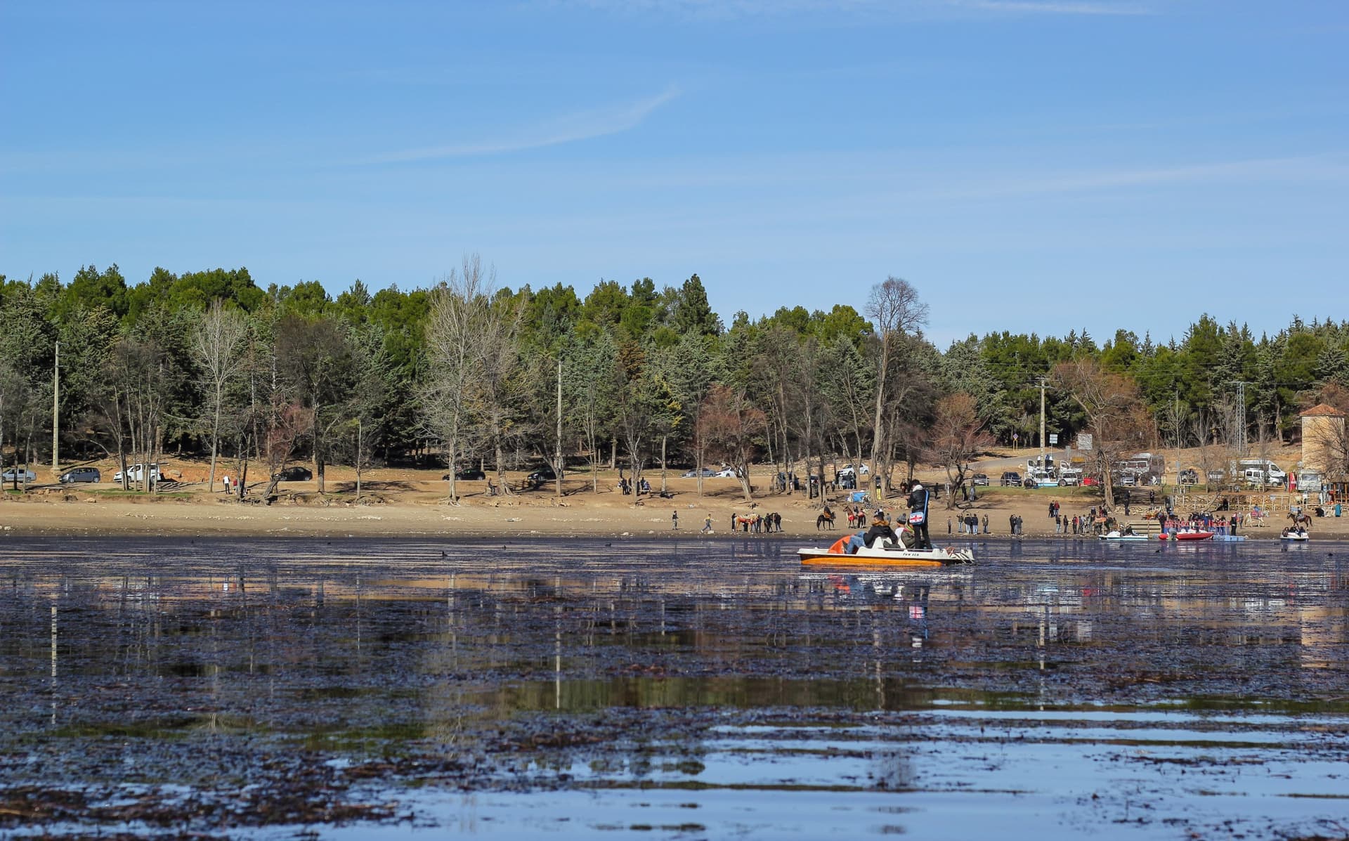
A high-altitude wetland classified as a historic monument, Dayet Aoua Lake is located 15 km from Ifrane, in the heart of the Middle Atlas, between cedar forests and wet meadows.
Dayet Aoua Lake, a high-altitude wetland in the Middle Atlas
Located 15 km from Ifrane and 8 km from Imouzzer Kandar in the direction of Fès, Dayet Aoua Lake is a high-altitude wetland perched at 1,460 meters. Classified as a historic monument on August 28, 1950 by vizierial decree, this 140-hectare site is among the rare lacustrine mountain ecosystems in Maroc, nestled between cedar and oak forests. Its history is marked by cycles of desiccation and reflooding that make it a fragile place, today targeted by an ecological rehabilitation program.
Why visit Dayet Aoua Lake
The site holds natural, scenic, and historical interest. Amateur ornithologists observe significant bird populations during migration season, while hikers appreciate the contrast between the lake basin and the surrounding cedar forest. Several habitats coexist within a confined area:
- shallow waters and mudflats,
- wet meadows and marshes,
- forests of Atlas cedar and evergreen oak.
The lake also serves as a peaceful stopover on an itinerary through the Middle Atlas, between Ifrane, Azrou, and Fès.
Lake history and desiccation cycles
In the 1930s, the French Protectorate authorities built a dam to control flooding and stabilize the water level. The lake then became a regional tourist hub, prized for swimming, trout fishing, and pedalo rides. Hotels were built nearby to accommodate visitors seeking to enjoy the setting.
From the 1980s onward, water levels began to decline. The lake dried up completely in 1994, before returning to normal levels in 1997, then experiencing a new decline from 2006 onward. The springs that feed it — Aïn Layoune (the "source of sources"), Aïn Rouda, and Wadi El Harhar — now provide limited flows, dependent on winter rainfall.
An ecological rehabilitation project, endowed with a budget of 6.1 million dirhams, plans engineering studies, canal development, and water preservation, with the aim of fostering the return of migratory birds and revitalizing local tourism.
What to see and do here
Flora and fauna
The wetland is home to 37 mammal species and 140 bird species. In winter, when water levels rise, herons and flamingos frequent the shoreline. The aquatic and marsh vegetation includes notably Scirpus lacustris, Myriophyllum spicatum, Typha sp., Juncus bufonius, Ranunculus millifoliatus, Carex sp., Polygonum amphibium, and Phragmites communis.
Lake circuit walk
A walking loop allows you to skirt the basin, with a maximum depth of 5 meters (4 to 5 m upstream, lower section silted). The trail crosses wet meadows and cedar forest edges, offering views over the basin and Middle Atlas relief.
Local atmosphere
Around the lake, local youth sometimes organize impromptu horse races, a vestige of the tourism activity from years past. The atmosphere remains rural, punctuated by herds and the passage of walkers.
When to visit Dayet Aoua Lake
The climate is warm and temperate, with an average annual temperature of 13.5 °C and 651 mm of annual rainfall, concentrated in winter. Your choice of season depends on your objectives:
- Winter (December to February): water level at its highest, presence of migratory birds (herons, flamingos). Ideal period for bird watching, but with cool temperatures and possibility of snow.
- Spring (March to May): blooming wet meadows, mild climate, favorable conditions for hiking.
- Summer (June to August): pleasant temperatures thanks to altitude, but low water levels and more pronounced silting in the lower section.
Practical information
- Altitude: 1,460 m
- Area: 140 hectares
- Maximum depth: 5 m
- Status: classified historic monument (August 28, 1950)
- Visit duration: allow 1 to 3 hours depending on the walk around the lake
- Access: free, natural site with no enclosure
- Equipment: hiking shoes, binoculars for bird watching, warm clothing in winter
No major tourist facilities are located on-site: plan for water and snacks, and prefer Ifrane or Imouzzer Kandar for accommodation and dining.
How to get there
From Ifrane, located 15 km south of the lake, take the RN24 in the direction of Fès. The road crosses the Middle Atlas cedar forest before skirting the basin. From Fès, allow about 50 km via the same RN24 axis. There is no direct public transport: a car (rental or private taxi from Ifrane) remains the most practical option.
What to see nearby
Dayet Aoua Lake integrates easily into a circuit through the Middle Atlas and more widely in Maroc:
- Ifrane, a high-altitude resort with Alpine charm, an ideal base for exploring the region.
- Attiq Falls, another natural site in the Middle Atlas.
- The Bou Inania Medersa in Fès, a masterpiece of Merinid architecture.
- The Ben Youssef Medersa in Marrakech, to further explore heritage sites.
Plan your trip to Maroc
Dayet Aoua Lake finds its place in an itinerary blending imperial heritage, Middle Atlas mountains, and historic cities. To build a coherent circuit, consult our bespoke trips to Maroc.
Interested in this visit?
We can include it in your personalised itinerary.